Seasonally day with evening rain chances, new First Warn for Friday
KANSAS CITY, Mo. (KCTV)— A cooler weather pattern has taken over the region this week. Rain and storm chances are on the rise for the holiday weekend and a new First Warn has been issued for Friday.
We’ll have sunshine and temperatures in the 60s by noon. High temperatures will reach 70 degrees by the afternoon with some clouds starting to filter in too.
While the 70s are warmer than yesterday, we usually average 76° this time of year,
This evening we should be pretty cloudy and starting around 6, spotty to scattered rain and thunderstorm chances build along I-70 and will sink south through the night.
THURSDAY: Rain chances hold off Thursday. We will see mostly sunny skies, and high temperatures will only reach the upper 60s.
MEMORIAL DAY WEEKEND: Temperatures in the mid to upper 60s are expected Friday and through the Memorial Day holiday. Unfortunately, on top of the cool temperatures, rain chances will really ramp up for the weekend. The good news is that no day will be an all-out washout, and there will be a lot of dry time. The not-so-good news is that when it’s dry, temperatures will be cool.
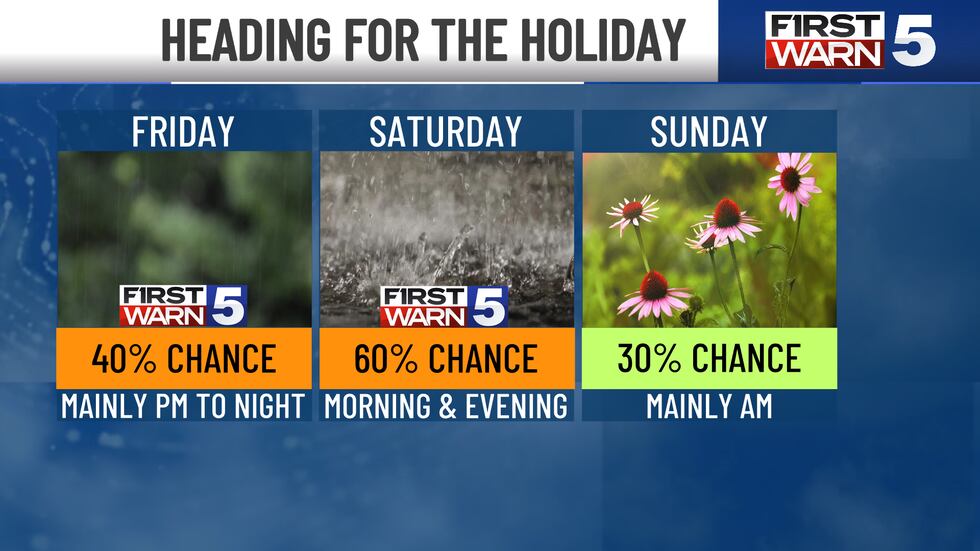
Spotty rain chances are possible Friday, mainly in the evening into the night.
A New First Warn as been issued for Friday as scattered rain and storms will be possible across the area during afternoon and evening hours. No severe weather is expected at this time.
We do have a First Warn Saturday for 60% rain and storm chances. At this time, rain and storms look possible in the morning and then again in the evening into Saturday morning. Heavy rainfall may be possible Saturday evening into Sunday morning. Sunday chances are at 30%. We continue to trend down rain chances to 20% for Memorial Day.
To get the latest weather updates sent to your phone, the KCTV5 Weather app here.
Copyright 2025 KCTV. All rights reserved.


