Pleasant spring-like afternoon with breezy conditions
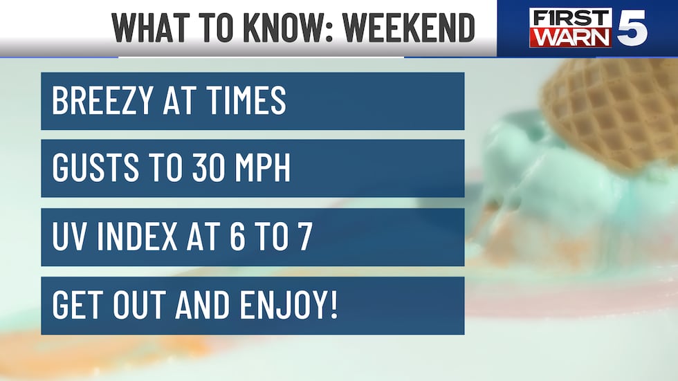
KANSAS CITY, Mo. (KCTV) - Today will be warm, mostly sunny, and breezy. High temperatures soar into the mid to upper 70s across the area. Winds will be sustained between 15 to 20 mph with gusts to 30 mph
Make sure to get out and enjoy the nice weather. UV Index values will range from 6 to 7 over the weekend so make sure to break out the sunscreen once again!.
Sunday will be the warmest day of the year so far... and the warmest day since October 9th of last year! Morning temperatures start warm in the upper 50s, and we will rise quickly into the mid-80s by the afternoon. Some areas in the west will have the potential to reach 90 degrees. Sunday will start on the mostly sunny side, but clouds will start to build in the afternoon. Breezy conditions will remain with gusts to 30 mph in the metro, but gusts to 40 mph will be possible in the southeastern areas.
Unfortunately, the 80-degree day will be a one-hit wonder for this 7-day forecast, as a strong cold front will drop through late Sunday. Monday will be 20 degrees colder than Sunday. High temperatures only make it to the mid-60s and will be paired with breezy conditions. Monday morning will also start with spotty rain and thunderstorm chances mainly along and north of I-70; we should be dry by the afternoon. Next week will bring a few more small rain chances Wednesday through Friday, and temperatures will remain in the mid-60s to mid-70s.
To get the latest weather updates sent to your phone, the KCTV5 Weather app here.
Copyright 2025 KCTV. All rights reserved.


