Nearly perfect weather for now, wind storm & possible severe weather ahead
KANSAS CITY, Mo. (KCTV) - This stretch of weather we are in at the moment is magical. 70s, sunshine, and light winds will be the rule for the next couple of days. But by the end of the week, a powerful storm system will kick up very high winds and possibly some strong to severe thunderstorms. We are First Warning Friday for both of these impacts, with a First Warn for Saturday as well due to wind and a cool-down.
Tonight we will see some clouds move in and out as low temperatures only fall to the mid 40s.
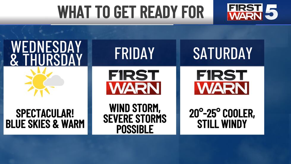
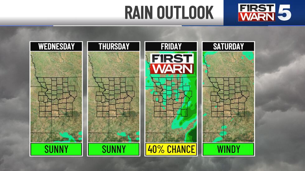
As we move forward into Wednesday and Thursday’s forecast, the temperatures steadily climb to the low and mid 70s and then yet again to the upper 70s, with potential lower 80s on Thursday afternoon. Mostly sunny to partly sunny skies remain, and wind remains relatively mild. As we transition into Friday, the wind will begin to pick up, and gusts will take over as the next storm system moves into the area.
A First Warn is in place for Friday’s rain, storm, severe storm potential and windy conditions. Severe weather is still possible towards our eastern counties with a small opportunity for a level one severe weather risk stretching over to the metro. The severe weather system itself could produce widespread damaging wind, tornado activity, some being rather strong and a large size hail, but these weather features are more likely to occur east and south of the viewing area. Of course, as we approach closer to the end of the work week, we will see much more detailed information regarding this weather pattern.
Once the storm system es which we anticipate early morning of Saturday, wind gusts up to 35 mph through the rest of Saturday morning or Possible and along with temperatures featured in the lower and middle 40s, feel like temperatures are expected in the lower 30s. The afternoon will bring partly sunny skies with temperatures in the middle 50s.
By Sunday, mostly sunny conditions with lighter wind and no gusts are expected, along with temperatures rising to the upper 50s and lower 60s. By St. Patrick’s Day Monday, we will rebound back to the upper 60s and lower 70s, keeping sunshine
To get the latest weather updates sent to your phone, the KCTV5 Weather app here.
Copyright 2025 KCTV. All rights reserved.


